


GIS Power for Location-Based Smart Decisions with i-frame
Geographic Information Systems (GIS) are a set of integrated systems that enable the collection, storage, analysis and visualization of location-based data. It guides decision-making processes by making sense of spatial information; it provides organizations with answers not only to the question of “where” but also to the questions of “why here” and “how to make it better”.
The Difference Between Traditional Methods and i-frame
Traditional GIS solutions often required high hardware investments, separate software systems and manual data management processes. Since data from different sources could not be integrated, analysis processes were limited. Visualization was performed through separate tools.
How i-frame Transforms This Process
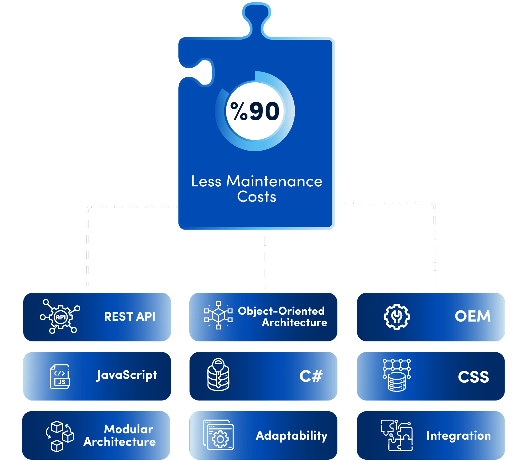
i-frame does not only offer GIS infrastructure as a map visualization tool; it makes it an active component of business processes. In other words, the user can not only mark a region on a map, but also manage all functions such as approval processes, asset management, document links or risk scoring on the same platform. Thus, geographic data is no longer a static source of information, but a dynamic decision support mechanism.
- The GIS module is embedded in the platform.
- Data is processed directly in the platform with structures such as points, lines, polygons.
- By working integrated with other modules, it transforms spatial analysis into business processes.
- Maps and reports can be presented directly in dashboard components.
Empowering businesses with GIS solutions
Ease of Use and Integration Capability
| Feature | Traditional Methods | i-frame |
|---|---|---|
| Hardware Requirement | High, specialized systems | Web-based, no installation required |
| Map Processing | External software is used | Real-time visualization with built-in components |
| Data Layers | Managed in separate files | Multi-layer management within the platform |
| Integration | Requires additional software or middleware | Comes with ready REST API and GIS integration |
| Mobile Compatibility | Limited | Responsive and device-independent |
| Data Analysis | Manual | Automatic reporting and map-based filtering |
Key Features
GIS Compatible Object Oriented Architecture
Each location can be defined as an object in the system. The areas defined on the map can be connected to processes and made meaningful.
Data Visualization on a Map
Map layers are integrated into the dashboard module and simple, interactive and analysis-oriented report screens are presented to the user.
Integration with Data Layers
Satellite imagery, plot data or GIS data sources can be made part of process decisions in the system.
Widespread Geographic Format Support
Standard file formats such as KML, SHP, GeoJSON are supported and work with different projection systems.
Authorization and Security
Geographical data is authorized on a user and role basis according to its sensitivity and recorded with logging.
Where is i-frame used?
- Zoning, transportation and infrastructure planning in urban planning projects
- Water resources, forest and waste monitoring in environmental management
- Impact area visualization in disaster and crisis management
- Geographical analysis in energy and mineral exploration
- Logistics, marketing, sales distribution analysis
- Location-based process tracking of public institutions

Who is using it?
- Urban planners and public administrators: Those who want to base spatial decisions on data
- Engineering and infrastructure teams: Those who manage operations with real-time map analysis
- Disaster management and environmental analysts: Those who want to predict risks spatially
- Corporate decision makers: Those who want to visualize regional performance and potential
- All users: Anyone who wants to create simple, functional solutions with complex geographic data

Advantages of Using i-frame
- Integrated and sustainable management of geographic data within the platform
- Hardware-free, web-based geospatial solution
- User-specific map layers and reporting
- Transforming GIS data into business processes
- Embedding spatial data in institutional memory
- Supporting a culture of map and process-based decision making